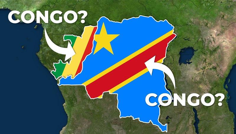
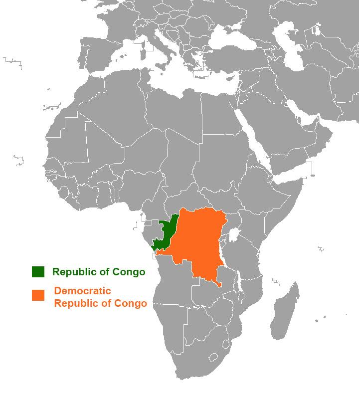
When you hear the word “Congo” in the context of countries, you’re referring to one of two countries that share the Congo River in central Africa. Congo gets its name from the Bakongo, a Bantu tribe that lives in the area. The Democratic Republic of the Congo, the bigger of the two countries, is located to the southeast, while the Republic of the Congo is located to the northwest.
Both countries are separated by the river that bears their names.
Despite the fact that they have the same name, each country has its own unique history and statistics. Continue reading to learn more about these two countries that are related but distinct.
The Democratic Republic of the Congo
Kinshasa is the capital and largest city of the Democratic Republic of Congo, which is also known as “Congo-Kinshasa.” The Democratic Republic of Congo was once known as Zaire before receiving its current name.
The Central African Republic and South Sudan are to the north; Uganda, Rwanda, and Burundi are to the east; Zambia and Angola are to the south; and the Republic of Congo, the Angolan exclave of Cabinda, and the Atlantic Ocean are to the west. The country has access to the ocean via a 25-mile stretch of Atlantic shoreline at Muanda and the Congo River’s mouth, which is around five-and-a-half miles wide and opens into the Gulf of Guinea.
The Democratic Republic of Congo is Africa’s second-largest country, with a total area of 2,344,858 square kilometers, slightly larger than Mexico and almost one-quarter the size of the United States. It is estimated that the population is at 86.8 million people (as of 2019).
Republic of the Congo
The Republic of the Congo, sometimes known as Congo Brazzaville, is located on the western border of the Democratic Republic of Congo. Brazzaville is the capital and largest city in the country.
The Republic of the Congo has a population of 5.38 million people and occupies an area of 132,046 square miles (as of 2019).
The following are some interesting facts about the country’s flag:
“A yellow band runs diagonally from the lower hoist side; the upper triangle (hoist side) is green, and the lower triangle is red; green represents agriculture and woods, yellow represents people’s friendship and nobility, and red represents the struggle for independence.”